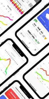
Survey point :

Download the app

Share this diabox

Informations

  • Installation date : 31/05/16
  • City : Lampaul-Plouarzel
  • GPS coordinates :
    Latitude : 48° 26' 45.96” N
    Longitude : 4° 46' 36.80” W
Marker
Leaflet © OpenStreetMap contributors
Warning: wind data is currently unavailable due to a sensor malfunction. Maintenance is planned.

Live data

Date of the lastest data : 6/3/2022 4:18:41 PM
Temp / Press
Created with Raphaël 2.1.2
12.4 °C
1/3/2022 9:22:29 AM
Created with Raphaël 2.1.2
1009.8 hPa
6/3/2022 4:18:41 PM
Wind
Created with Raphaël 2.1.2
0.0 °
1/1/1970 12:00:00 AM
Created with Raphaël 2.1.2
0.0 knots
1/1/1970 12:00:00 AM
Warning: wind data is currently unavailable due to a sensor malfunction. Maintenance is planned.
Hum / Pluvio
Created with Raphaël 2.1.2
97.0 %
1/3/2022 9:22:29 AM
Created with Raphaël 2.1.2
0.0 mm/h
1/3/2022 9:22:29 AM

Last hour data

Start
2025-05-09 20:55:00
(UTC+0200)
09/0509/0509/0509/0509/0509/0509/0509/0509/0509/0509/0509/0509/0509/0509/0509/0509/0509/0509/0509/0509/05
20h55m20h58m21h01m21h04m21h07m21h10m21h13m21h16m21h19m21h22m21h25m21h28m21h31m21h34m21h37m21h40m21h43m21h46m21h49m21h52m21h55m
Average wind (knots)?????????????????????
Gusts (knots)?????????????????????
Beaufort scale (bf)?????????????????????
Wind direction (°N)?????????????????????
Temperature (°C)?????????????????????
Pressure (hPa)?????????????????????
Relative humidity (%)?????????????????????
Images
Rain rate (mm/h)?????????????????????
Cumulative precipitation (mm)?????????????????????

Last 24 hours data

Start
2025-05-08 21:00:00
(UTC+0200)
08/0508/0508/0509/0509/0509/0509/0509/0509/0509/0509/0509/0509/0509/0509/0509/0509/0509/0509/0509/0509/0509/0509/0509/0509/05
21h00m22h00m23h00m00h00m01h00m02h00m03h00m04h00m05h00m06h00m07h00m08h00m09h00m10h00m11h00m12h00m13h00m14h00m15h00m16h00m17h00m18h00m19h00m20h00m21h00m
Average wind (knots)?????????????????????????
Gusts (knots)?????????????????????????
Beaufort scale (bf)?????????????????????????
Wind direction (°N)?????????????????????????
Temperature (°C)?????????????????????????
Pressure (hPa)?????????????????????????
Relative humidity (%)?????????????????????????
Images
Rain rate (mm/h)?????????????????????????
Cumulative precipitation (mm)?????????????????????????

Ces données vous sont fournies par la ville de Lampaul-Plouarzel.

Warning: wind data is currently unavailable due to a sensor malfunction. Maintenance is planned.
Porspaul est un port en échouage sur la commune de Lampaul-Plouarzel.
Situé au bord du chenal du Four, en face des îles Molène et Ouessant, il est exposé en hiver alors que l'été c'est un vrai havre de paix.
A l'intérieur, il est bordé par une belle plage de sable fin, abritée des vents de nord".
Il n'y a pas si longtemps, les gabarres de Lampaul venaient y charger du sable à marée basse.